
Free
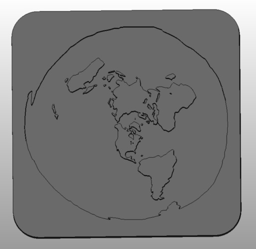
This is a Flat Earth model based on a flat-earth map found online.
Image file converted to .svg with picsvg, then imported in autodesk Fusion360 as a sketch, then extruded each area (water at 2mm and land areas at 10mm). Created a outer perimeter, combined and exported the .stl.
www.picsvg.com is a very handy site, especially if you're using black and white or line art images.
Loading prints...
Flat-Earth map
1
like
0
collections
Tags:
Creative Commons Attribution
You can distribute, remix, adapt, and build upon the material in any medium or format, as long as attribution is given to the creator.
 Licensed under CC BY
Files Included
1 downloadable file:
Free download - login required
Downloaded: 75 times
Downloaded: 75 times


Loading comments...